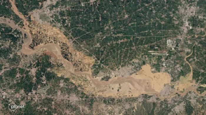
JACKSONVILLE, Florida. – MIT scientists are developing an artificial intelligence (AI) tool that generates realistic satellite images to illustrate potential flooding scenarios.
RELATED: Floods took away the love of his life after 35 years without a single day apart
According to Espace.comThe tool combines a generative AI model with a physics-based flood model to identify areas at risk of flooding.
It then creates detailed, bird’s-eye views of what the area might look like after a flood, based on the intensity of the approaching storm.
However, GANs (Generative Adversarial Networks) sometimes produce “hallucinations”, which are features of images that may appear realistic but are inaccurate or should not be present.
“Hallucinations can mislead viewers. We were thinking about how we could use these generative AI models in a climate impact context, where having reliable data sources is essential. This is where the physical model comes into play,” said Lütjens.
“The idea is that one day we could use this before a hurricanewhere it provides an additional layer of visualization to the public,” said Björn Lütjens, a postdoctoral researcher in the Department of Earth, Atmospheric and Planetary Sciences at the Massachusetts Institute of Technology (MIT). statement.
“One of the biggest challenges is encouraging people to evacuate when they are at risk,” Lütjens said. “Maybe this could be another visualization to help increase that readiness.”
To demonstrate the model, the researchers applied it to a scenario in Houston, generating satellite images of flooding in the city after a storm of similar strength to Hurricane Harvey.
They compared the AI-generated images to real satellite images and images created without the help of the physics-based flood model.
The AI images generated without the physics model were very inaccurate, exhibiting many “hallucinations”, mainly showing flooding in areas where this would not be possible.
In contrast, images produced using the physics-enhanced method closely matched the real-world scenario.
Scientists believe that this technology will be useful in predicting future flood scenarios.
It will provide reliable visuals that will help policymakers prepare and make informed decisions regarding flood planning, evacuation and mitigation efforts.
In their press release, the scientists noted that policymakers typically assess potential flooding areas using visualizations, often color-coded maps.
“The question is, can satellite image visualizations add another level to this, a little more tangible and more emotionally engaging than a color-coded map of reds, yellows and blues , while remaining trustworthy?” » says Lütjens.
Currently, the team’s method is in the proof-of-concept stage and requires more time to analyze other regions to more accurately predict the outcomes of various storms.
“We show a concrete way to combine machine learning and physics for a risk-aware use case, which requires us to analyze the complexity of Earth systems and project future actions and possible scenarios to keep people safe danger.” said Dava Newman, AeroAstro professor and director of the MIT Media Lab. “We look forward to putting our generative AI tools in the hands of decision-makers at the local community level, which could make a significant difference and perhaps save lives.” »
Copyright 2024 by WJXT News4JAX – All rights reserved.


